Conference on Cultural Heritage and New Technologies
November 8-10. 2017. Vienna, Austria
Science
10.03.2017
3D DOCUMENTATION IN UNDERWATER ARCHAEOLOGY
Photogrammetry, Georeferencing, Monitoring, and Surveying
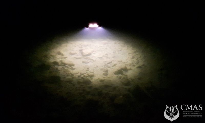
Archaeological underwater excavations are destructive and unrepeatable processes. The workflow of underwater site documentation is still complex and expensive. Diving operations, especially when photogrammetry is applied, need to be planned carefully. Sufficient, near-constant light conditions across several viewpoints and angles are required during image capture. Scientific drivers need special training and their diving times are strictly limited. Underwater georeferencing is another crucial challenge, because no GPS signal is directly available.
Beside the documentation of registered archaeological sites, the exploration of potential sites is a topic that attracts more and more attention. Unmanned Underwater Vehicles (UUVs,) can be used in both cases, careful and systematic excavation under water is still a domain of manual human labor.
Focussing on key aspects of managing underwater surveys, this session invites papers dealing with topics such as:
- complete workflows and case-studies
- decision/planning support processes for excavation campaigns
- camera and lighting solutions for underwater archaeology
- monitoring: continuous excavation and site recording for conservation and long-term studies
- and data management solutions for recorded data and long-term accessibility of 3D data
Contributions and perspectives are welcome, and may include the topics listed above or further improve established practise and processes.
More information at www.chnt.at/3d-documentation-in-underwater-archaeology
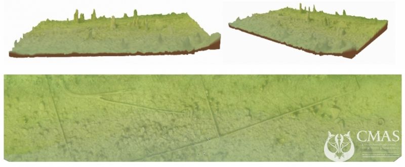
Pictures by Archaeonautic Projekt www.archaeocopter.de , Mondsee , Austria